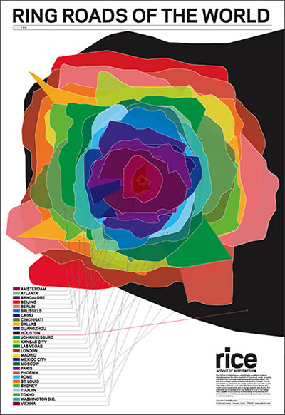
If it's not obvious, Houston is the black "smudge" in the background. And what is the outlying Ring? It's FM1960/Highway 6 which starts the upper right corner, in Liberty county, crosses lake Houston, wraps around the west side of Harris County and then cuts back South-East going almost all the way to Galveston Island.
This is particularly interesting to me because the entire time I've lived in the Houston area, I've lived near FM1960. My current neighborhood is very near the bend under the "O" in word "World" of title on the graphic where FM1960 heads North-East.
Here's the original article I took this from: Ring Roads of the World: Houston Wins! » Swamplot: Houston’s Real Estate Landscape
Of course, this graphic is only comparing single-city metro areas. Multi-city metros like Dallas-Fort Worth are bigger still.


No comments:
Post a Comment